

Ottawa Nav app for iPhone and iPad
Developer: Flybits Inc.
First release : 10 Oct 2013
App size: 24.29 Mb
Ottawa Nav is a first of its kind connected city platform allowing real time, zone based communication between the City of Ottawa and its citizens. This platform is managed using an administrative console controlled directly by City of Ottawa employees.
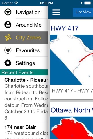
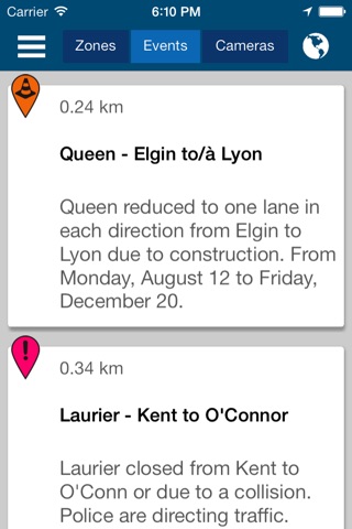
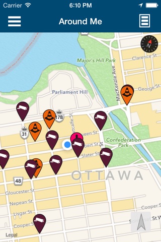
With a current emphasis on traffic, you get live camera, road and traffic information from a 2.5 or up to 100 kilometre radius, depending on your distance of travel. A unique zone centric navigation mode further helps in passing on information while on the go.
With zones, the City of Ottawa has turned every area to a smart space, catered to finding information easily, personally and instantly. For example:
At Parliament Hill? Check out their zone to see when theyre open, history about our country, and exciting events going on.
Near one of our great museums? Check out their zone to access their apps, opening times, and interesting exhibits.
In a city zone? Check out traffic cameras and events, plus other services such as OC Transpo and Pay by cell relevant to the zone you’re in.
Look forward to more zones being created around the city.
Ottawa Nav is an all Canadian connected city partnership is made possible using the award winning Flybits technology in collaboration with the City of Ottawa and Ryerson University.
Thank you for choosing Ottawa Nav. It is a central information hub for everyone in our great city. For support and feedback, please contact us at [email protected].
Stay tuned for new and exciting features in the future.
Continued use of GPS running in the background can dramatically decrease battery life.